


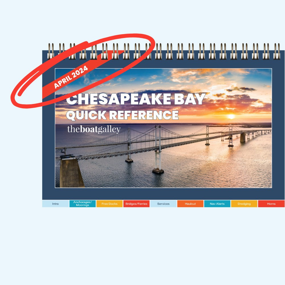
Chesapeake Bay Cruising Guide
Chesapeake Bay Cruising Guide
Eastern and Western Shores, Norfolk to the C&D Canal
- Spiral Bound (print) – $39.17 USD
- PDF download – $29.00 USD
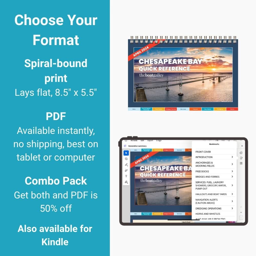
Also available for Kindle
Couldn't load pickup availability
Shipping and Returns

Free shipping on orders over $60 • $3 flat rate for packages under 1 lb
Discounted shipping for orders over 1 lb but under $60

Orders ship same day if placed by 2 PM ET (Mon–Fri, except holidays)

90-day free, no-hassle returns
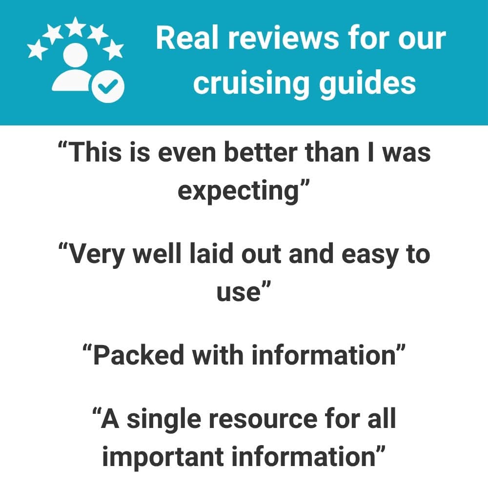
“I was tired of reading a chapter just to find a laundromat.”
With our guides, you'll never pore over pages of text, looking for one elusive word like "laundry" or "propane."
Our guides are built to help you find exactly what you need, exactly where you need it—fast.
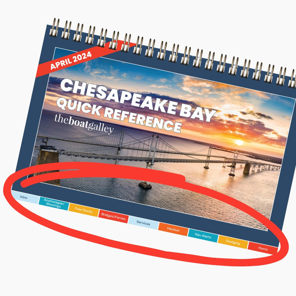
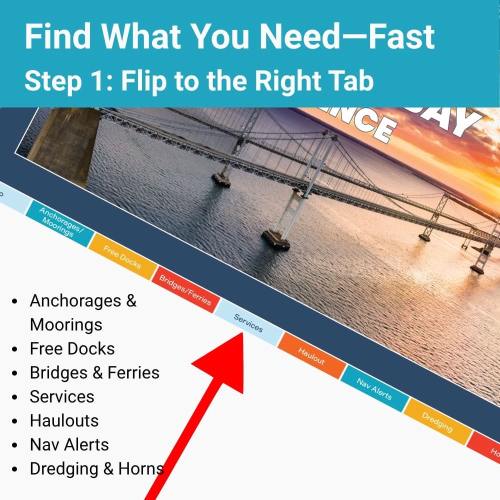
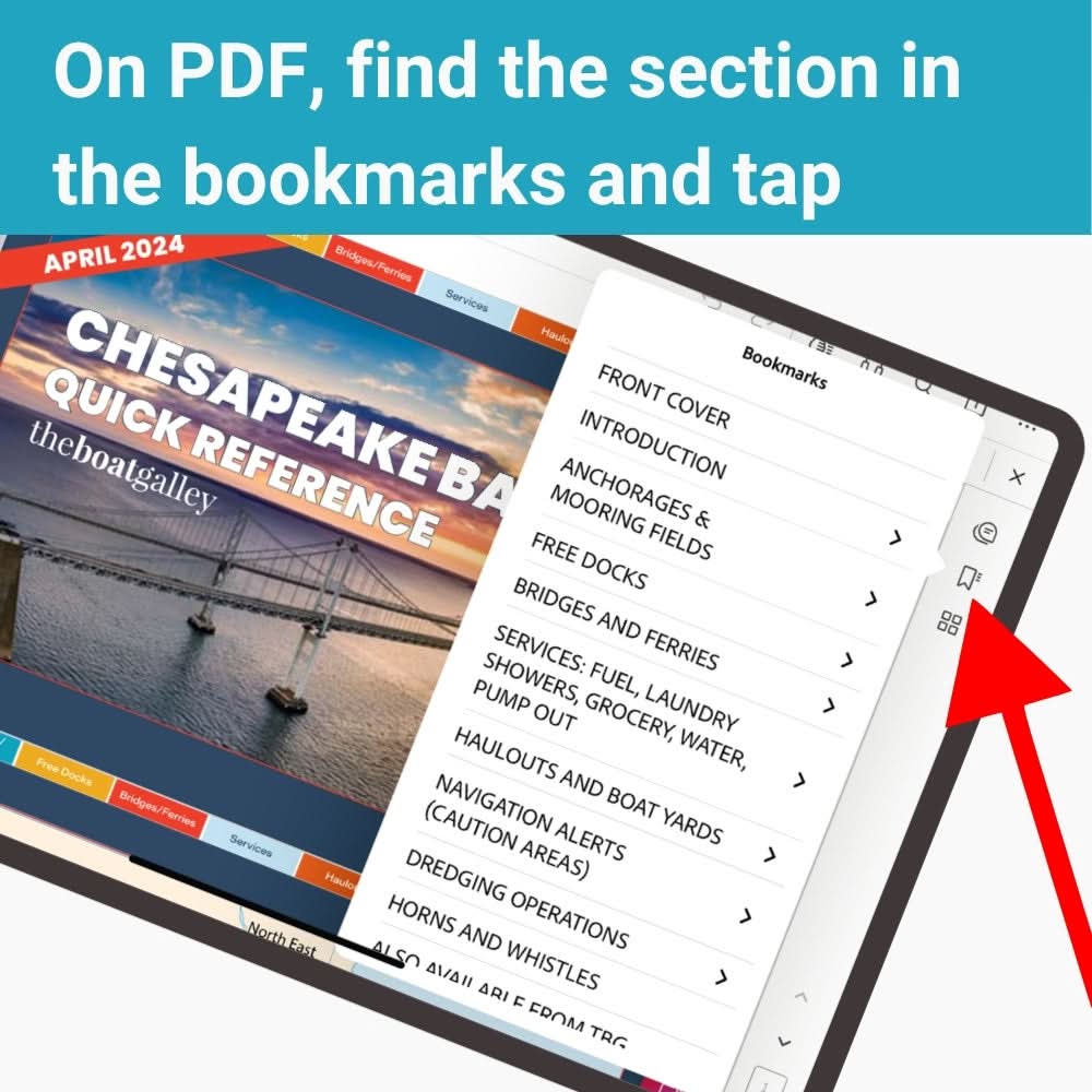
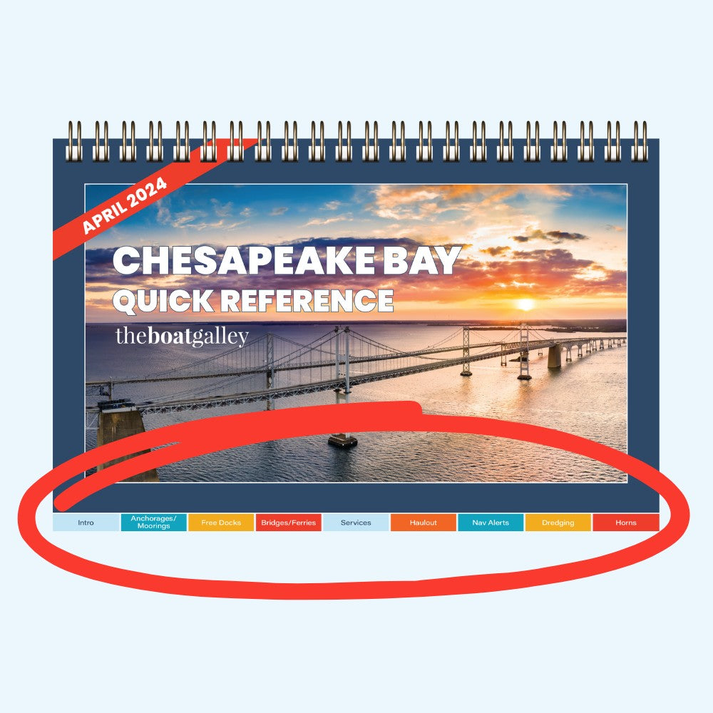
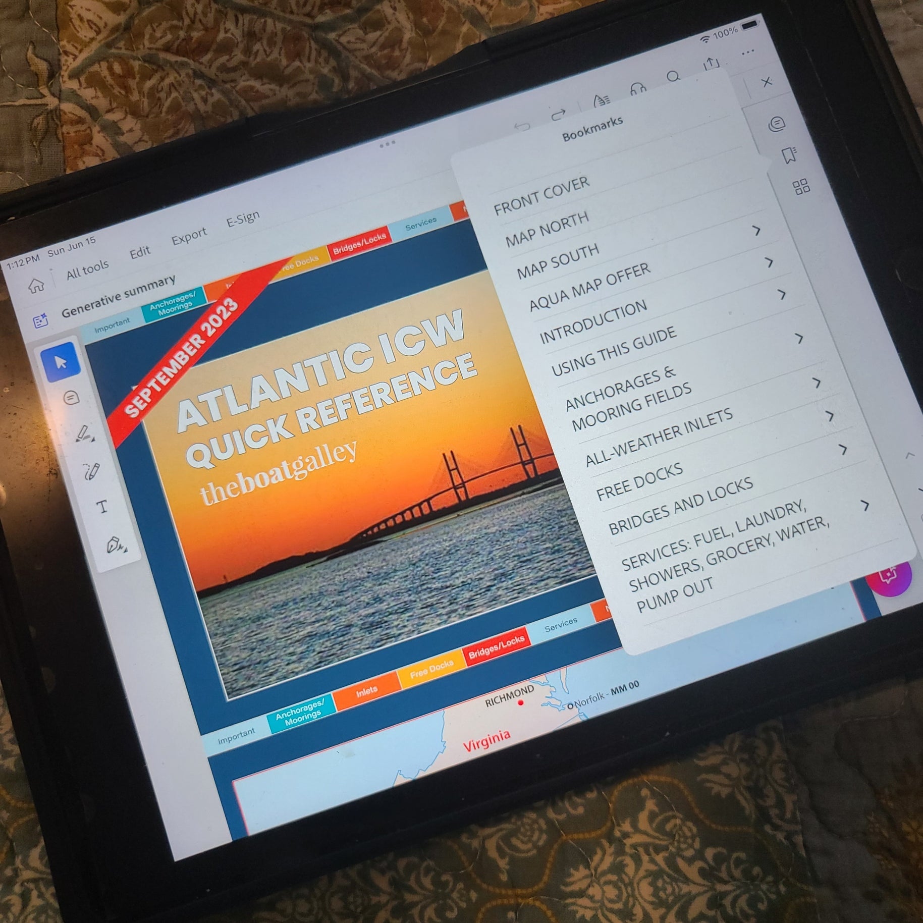
Go to the Right Section
Tabs help you find what you need—fuel, anchorages, bridges, or facilities.
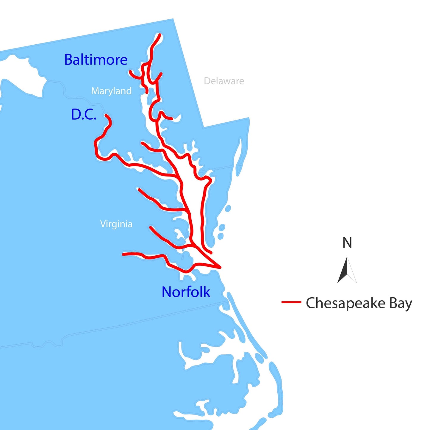
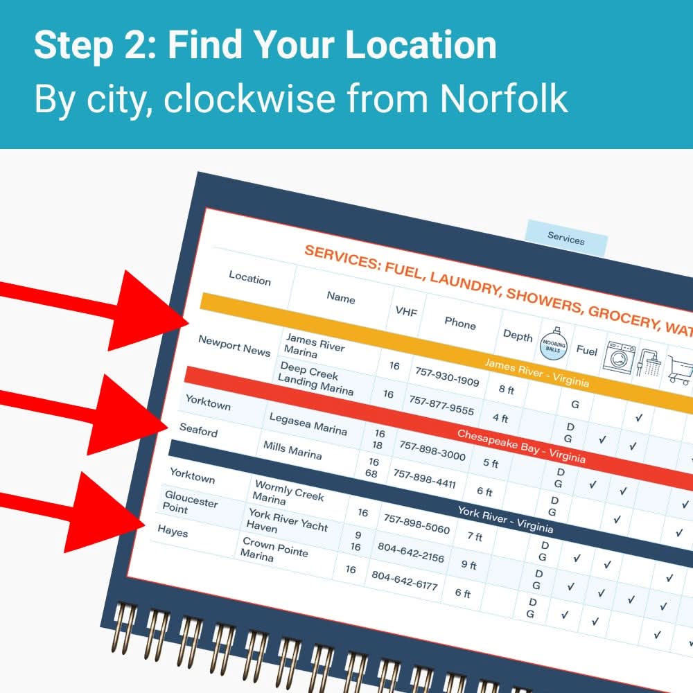
Find Your Location
By town/island name or ICW mile marker, in N-S order.
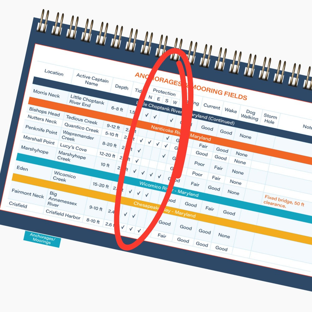
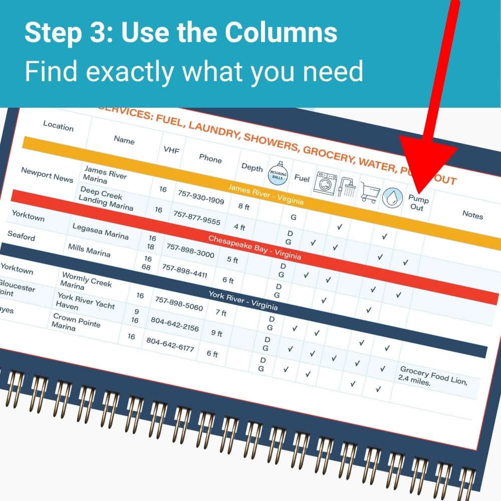
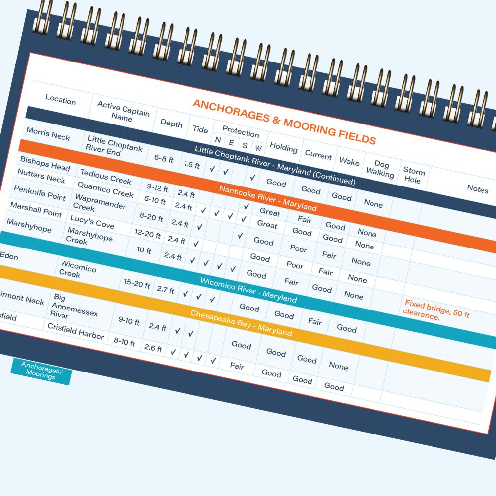
Check the Columns
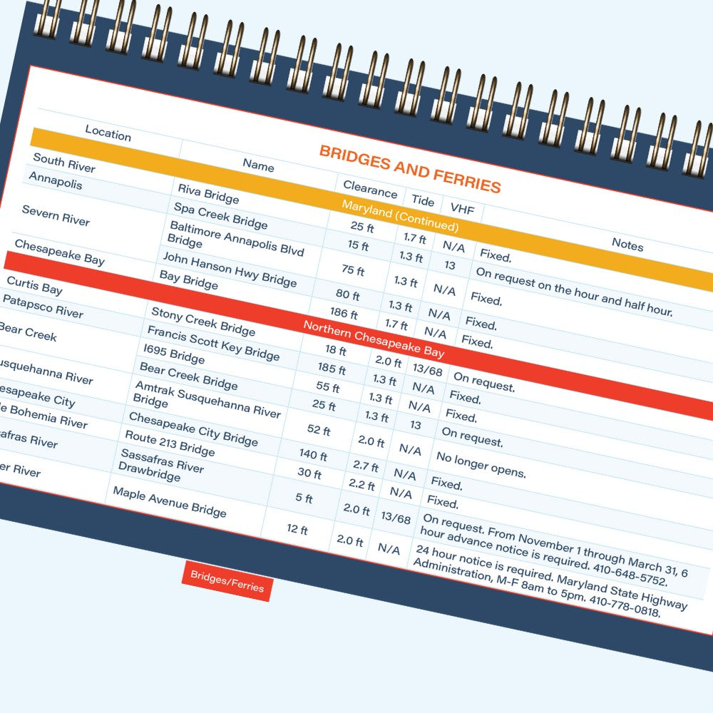
Look for details like wind protection, bridge heights, or marina services.
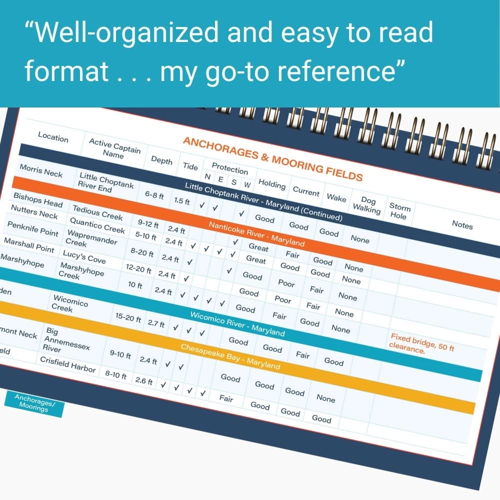
"The book makes it very easy to find the information you want and compare the different options."
What's Included
UP-TO-DATE
CATEGORIES
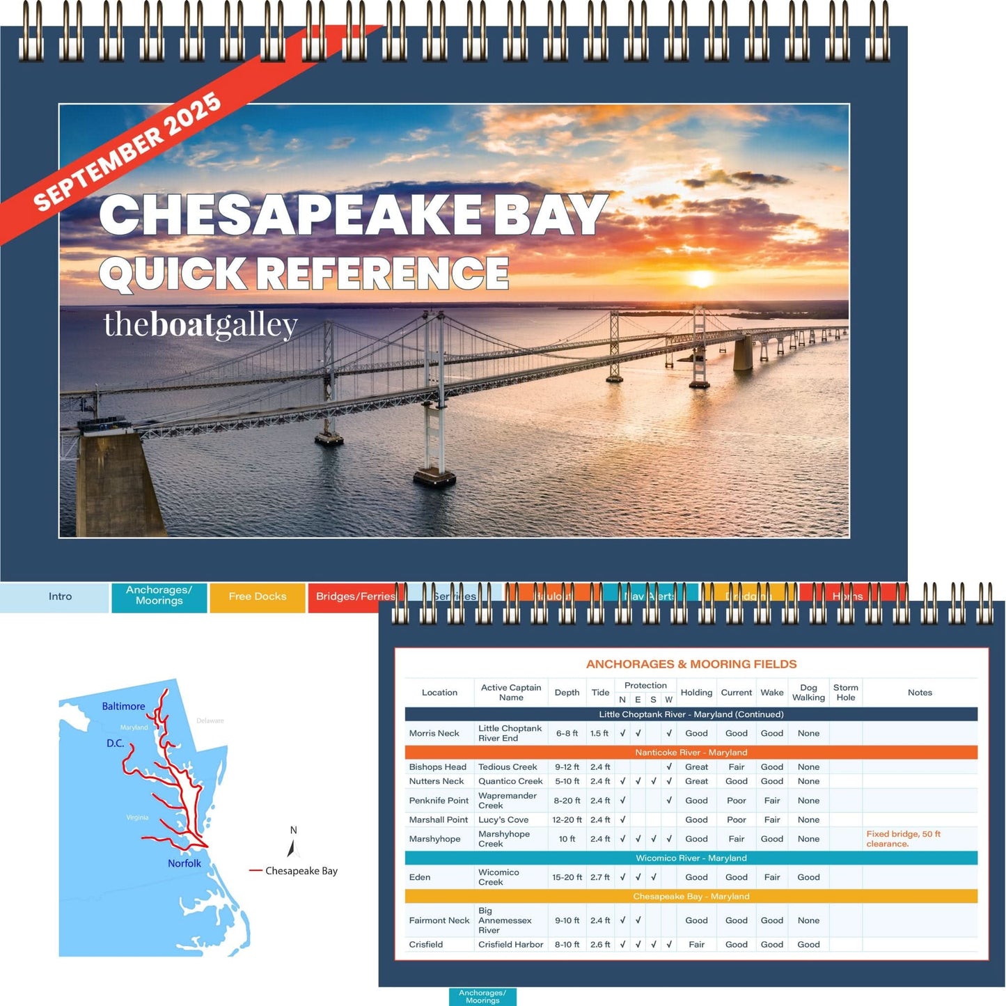
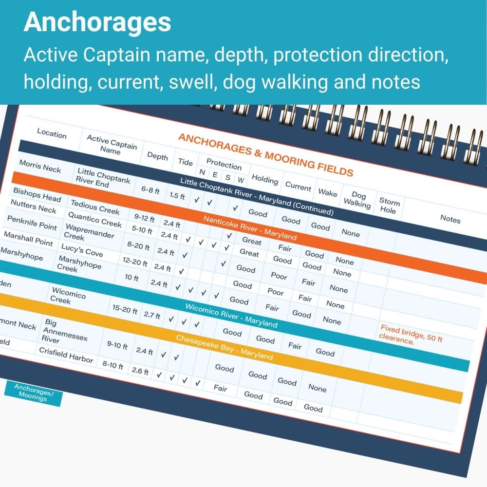
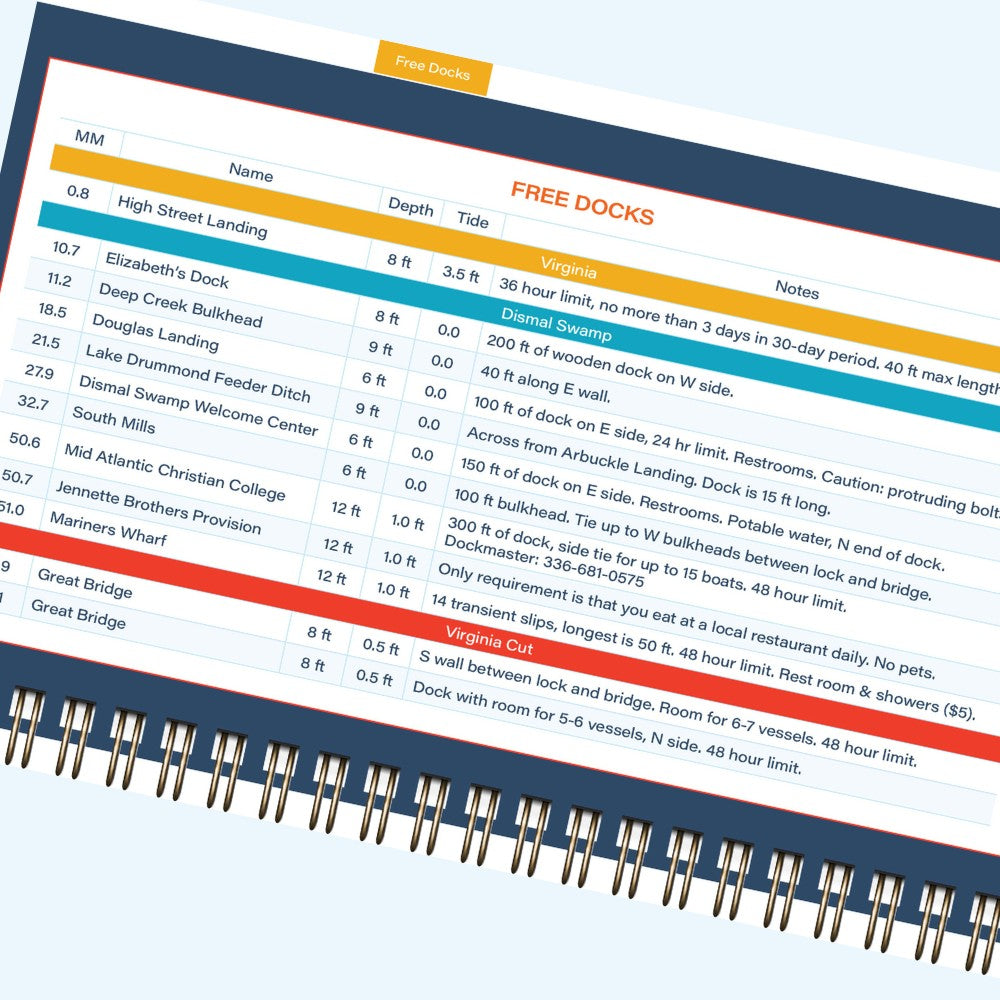
ANCHORAGES
FREE DOCKS
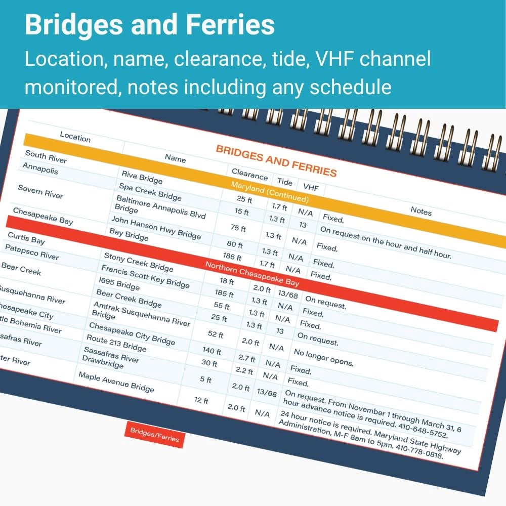
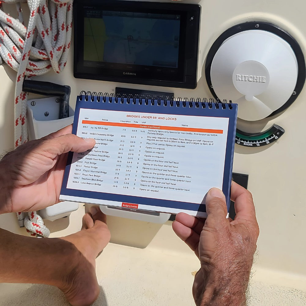
BRIDGES
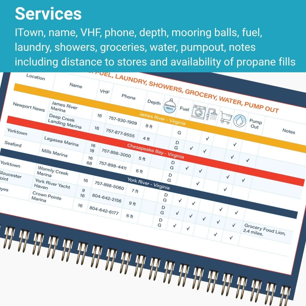
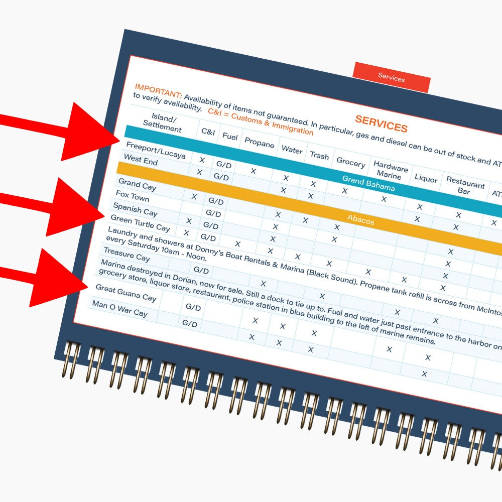
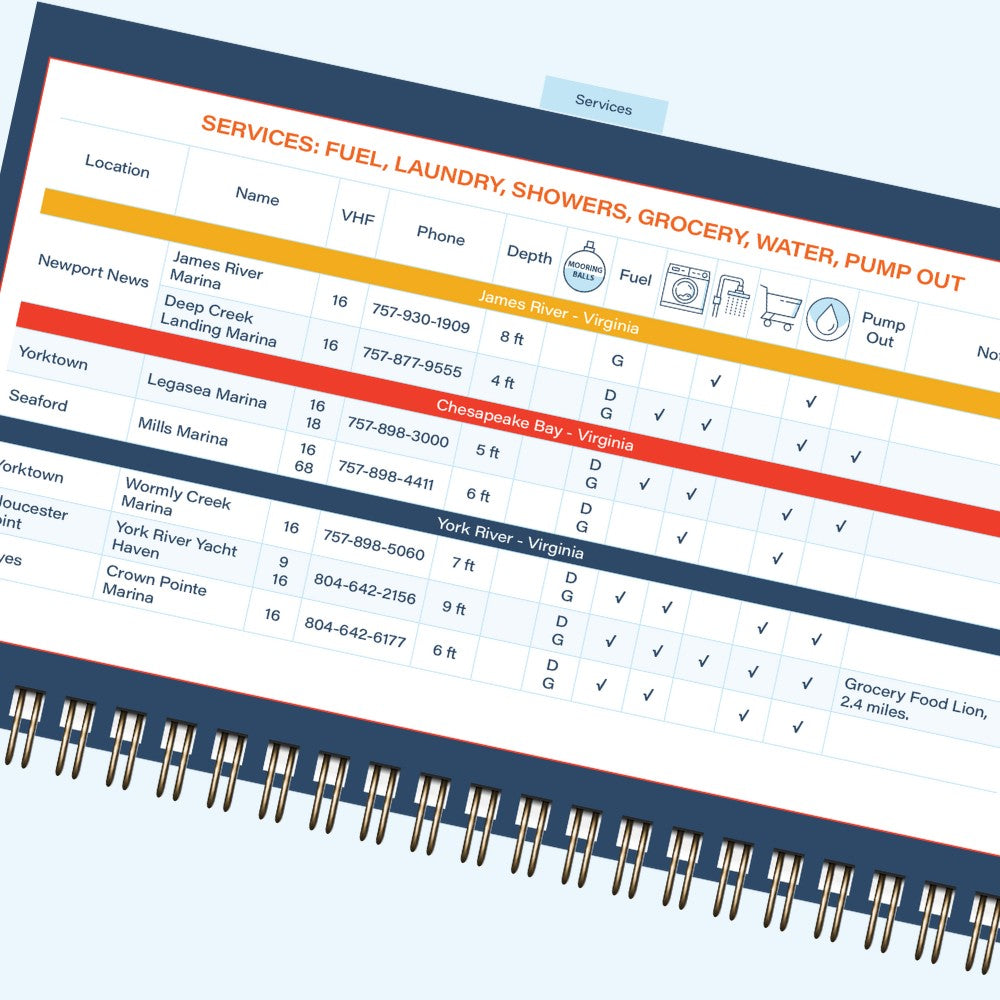
SERVICES
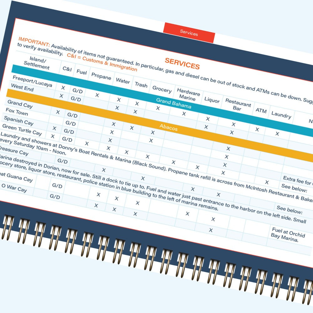
BAHAMAS
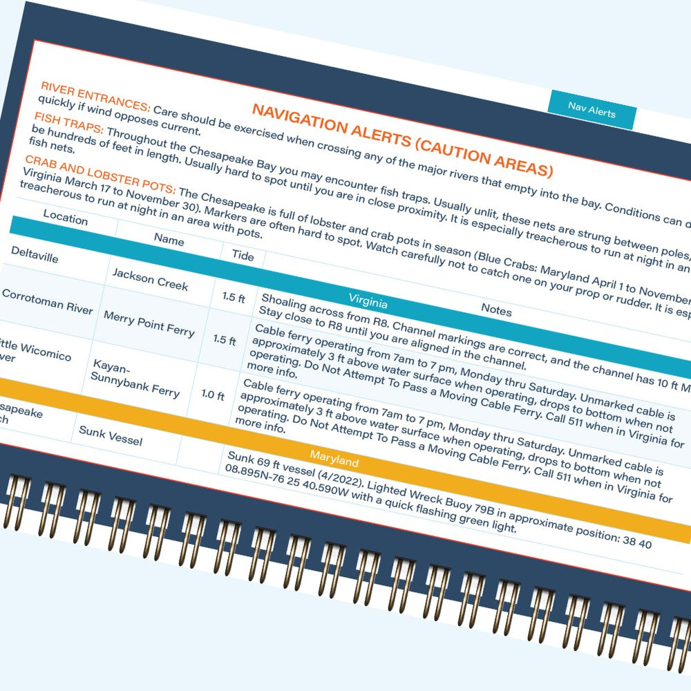
NAV ALERTS
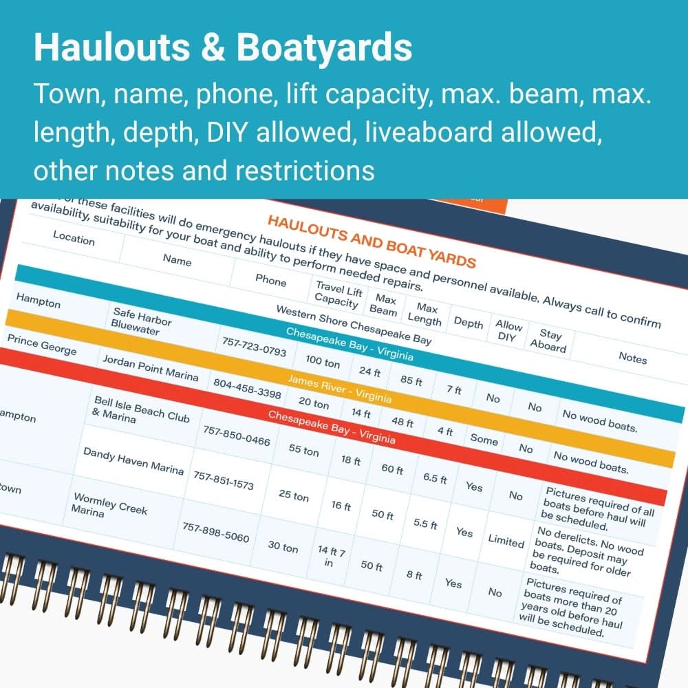
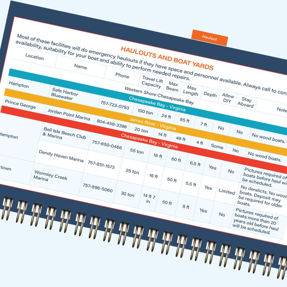
HAULOUTS
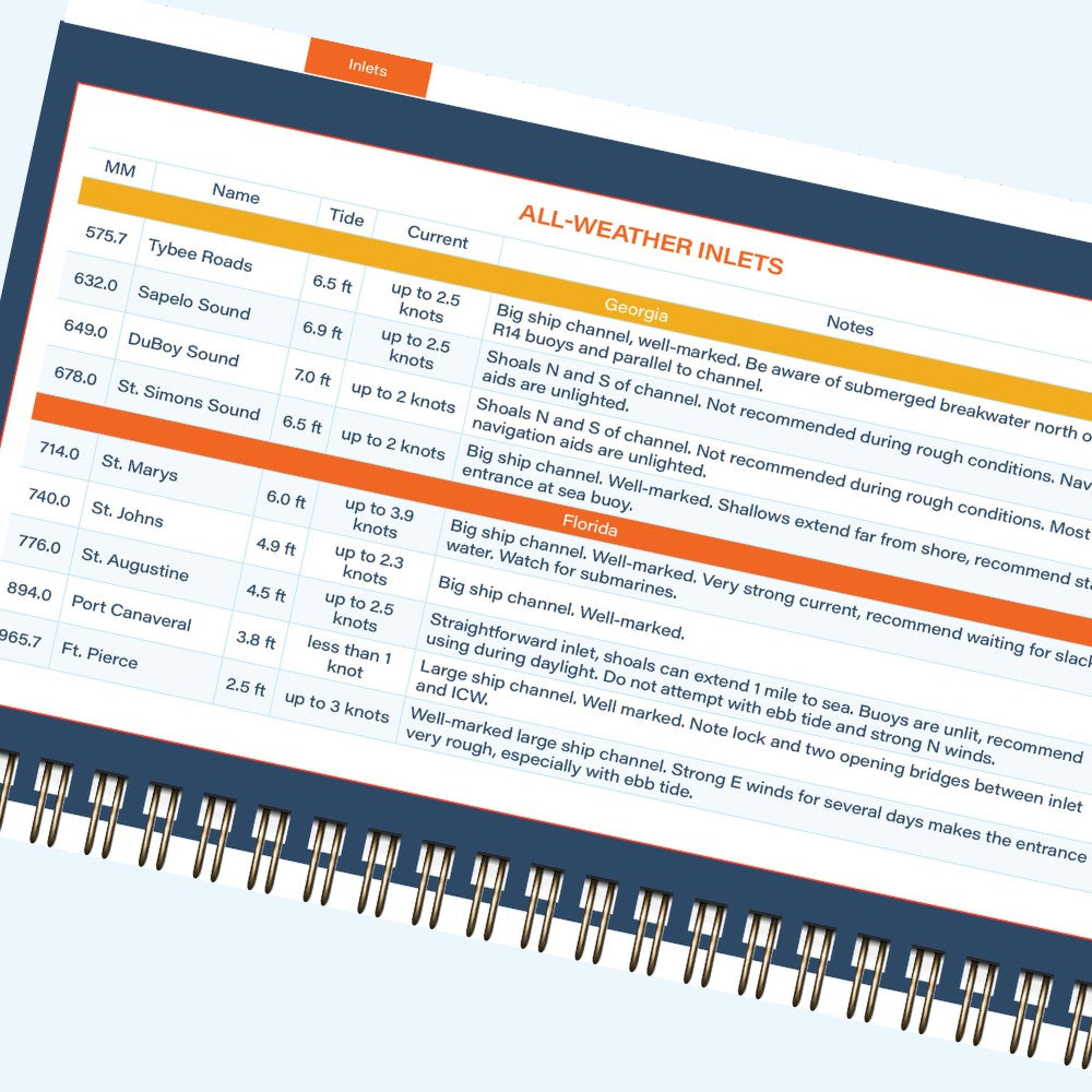
INLETS
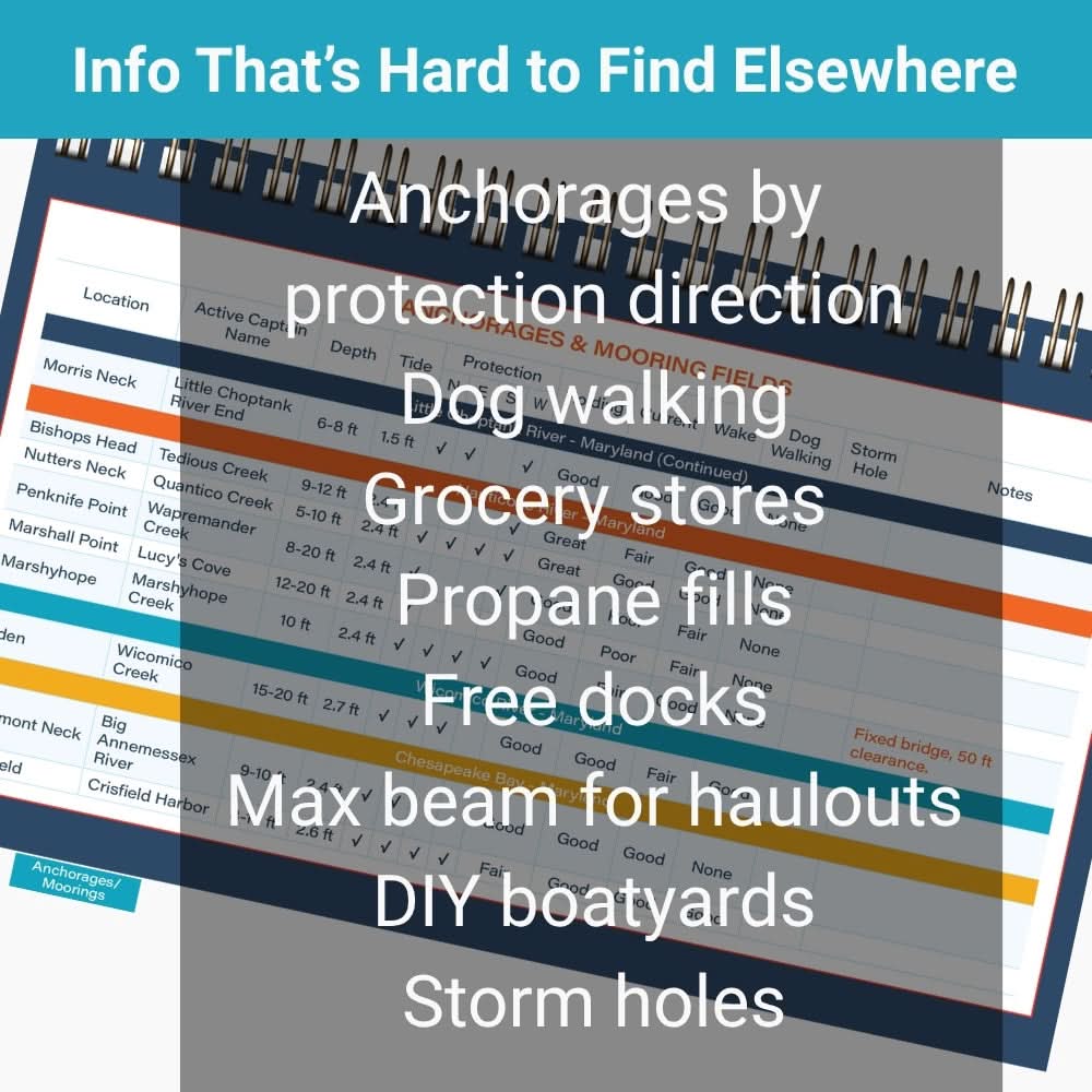
Info That's Hard to Find Elsewhere
-
Everywhere:
- Anchorages by protection direction
- Dog walking
- Grocery stores
- Propane fills
- Schedules for opening bridges
- Free docks
- Max beam for haulouts
-
Bahamas:
- Customs and immigration
- Propane
- Trash disposal
- Marine stores and hardwares
- Liquor
- Restaurants and bars
- ATMs
"I love that it has information to help make a decision on where to anchor based on wind direction."
Choose Your Format
Spiral-Bound Print
8.5" x 5.5" lay-flat design with heavyweight paper
Download instantly, no need for a shipping address, best on tablet or computer
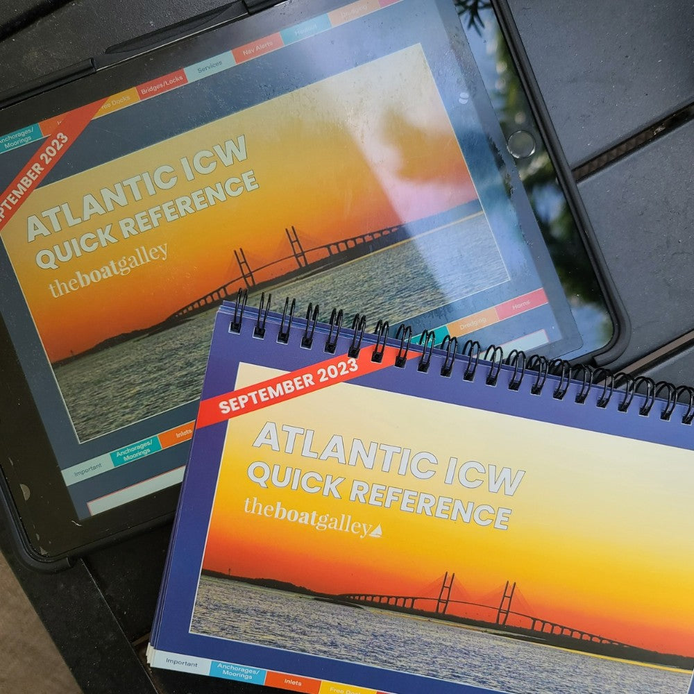
Print+PDF Combo
PDF is half off when you add both to the cart
"I use the PDF version on my tablet as well as the hardcopy in the cockpit."
More Details
PDF Details
Available immediately after purchase—no shipping needed.
- Clickable tabs let you jump straight to the right section.
- Searchable bookmarks make it easy to navigate the table of contents.
- Clickable links for phone numbers and websites simplify planning.
- Download to multiple devices used on the same boat for flexibility.
Anchorage Names
All anchorage names are Active Captain names, which can be overlaid on any navigation app.
Only One Ad
There's only one ad in the entire book -- and it provides a 20% discount on Aqua Map charts -- our favorite navigation app.
"Facilities, fuel/water/pumpout, free docks, anchorages, marinas, inlets, bridge openings/restrictions, currents and depths are listed concisely so there's no need to wade through wordy guides or individual reviews."
Designed in the USA; printed in the USA. Minimal packaging and tough enough to handle life on a boat.

At The Boat Galley, we have one mission: to help you cruise with confidence.
As liveaboard cruisers, we understand the challenges and questions that come with boat life. That’s why we create practical products and courses designed to tackle the same issues we’ve faced ourselves—making your life on the water easier, safer, and more enjoyable.
Try our products and courses for yourself. If they don’t make your boat life better, use our 90-day FREE no-hassle return guarantee.
-
Getting Your Chesapeake Bay Cruising Guide
-

Spiral Bound: Weighs 0.9 pounds
Eligible for flat rate shipping if total weight of all shipped items is under 1 pound
-

PDF: download immediately upon check out • No shipping
You'll get download link by email; no shipping address needed


Where You’ve Seen Us


Meet The Boat Galley Team
At The Boat Galley, we’re all cruisers. We know the joys—and the challenges—of boat life. The steep learning curve, costly mistakes, and hours spent searching for answers can be overwhelming. We’ve been there. That’s why we’ve created practical tools, trusted resources, and real-world guides to help you skip the frustrations and focus on enjoying your cruising life.
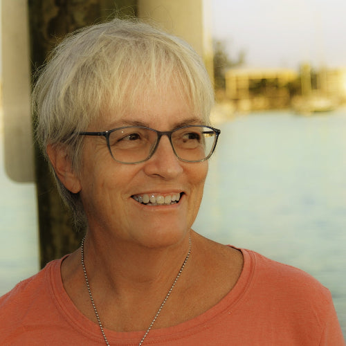
- Founder of The Boat Galley
- 17 years liveaboard cruiser
- US, Mexico, Bahamas, Central America, Virgin Islands, Turkey
- Cruisers University instructor

- Cruising Guide creator
- 6 years living aboard and cruising
- US East Coast from Florida Keys to Maine and Bahamas
- Ex-Air Force; singlehander
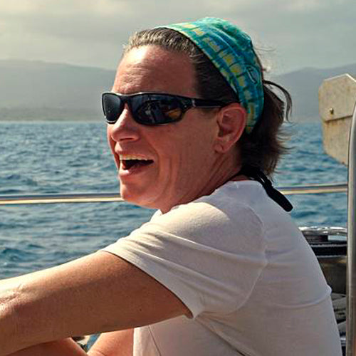
- Provisioning guru; podcaster
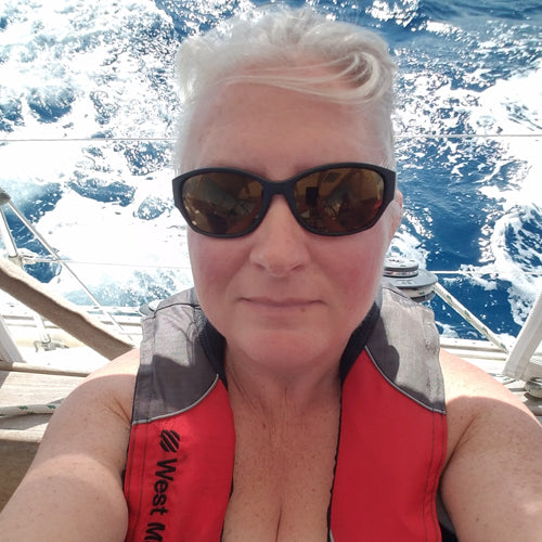
- On & off living aboard since 1992
- Atlantic crossing; US, Caribbean, and Bahamas
- Years of cruising with kids

- VHF pro and frugal cruiser
- Cruiser and delivery captain
- US East Coast, Bahamas, Haiti, and Caribbean
- Cruisers University instructor
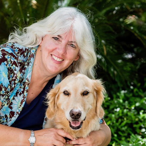
- Creator of Cruising With Your Dog
- 7 years cruising with Honey
- US East Coast and ICW
- Part of the Go Pet Friendly team
- 15+ years writing about dogs
- Graphics designer
- 8 years living aboard
- US East Coast to SE Caribbean
- Design and layout for all printed products
- Social media coordinator
- Pacific Ocean: Seattle, WA to New Zealand, incl. French Polynesia
- Complete newbie to sailing prior to her 11,000 nm voyage

- Boatshow booth "mom"
- Sabbatical and part-year cruiser
- US, Bahamas, Caribbean
- Family cruising New England to southern Caribbean
Curious about our story and what drives us? Learn more about us here.
